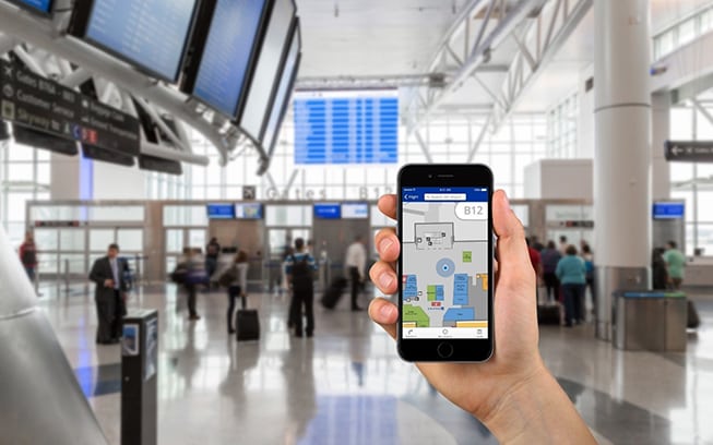
Finding your way around Houston’s airports will be as simple as checking your smart phone. George Bush Intercontinental (IAH) and William P. Hobby (HOU) will offer aturn-by-turn wayfinding technology through a new way-finding application on the airports’ flytohouston.com website. Houston Airport System says the technology, provided by San Francisco-based LocusLabs, will not require downloading a separate app to smart devices.
Once in place, travelers can access the interactive map technology from any device or browser, whether the device is mobile, desktop or tablet. The navigation tool provides transit path directions that will take the user to their destination. LocusLabs has named the technology “Maps Online.”
Maps Online offers users graphic and text directions as well as the estimated time it will take to walk to the destination. It offers searchable navigation, with location information, ticket, kiosks, shops, restaurants, security checkpoints and more.
“For the Houston Airport System, the accessibility of this new technology is as exciting as being chosen as pilot airports for its launch,” said Kathleen Boyd, head of marketing for the Houston Airport System. “The fact that there is no app necessary — that travelers at our airports can use it simply by going on their smart device — offers another powerful and valuable tool to our customers….”
“We are proud to partner with Houston Airport System, whose innovative thinking is bringing IAH and HOU passengers the optimal digital travel experience in whatever channel or app they may be using,” says Campbell Kennedy, co-founder and chief executive officer, for LocusLabs.